A Spatial History of Chile’s Central Power Grid: Population Data
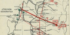
This is the first entry in a historical GIS project on the electrification of Chile. Here, I map the central power grid in conjunction with historical population data. These maps were also a final project in my intro to GIS course.
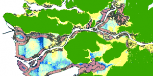
Lab 5 – Environmental Impact Assessment (GEOB 270/488)
Lab 4 for GEOB 270, an introductory GIS course at UBC. We were asked to assess the potential environmental impacts of a ski resort project.
Lab 4 - Rental Affordability in Vancouver (GEOB 270/488)
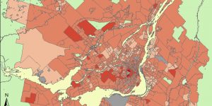
Lab 4 for GEOB 270, an introductory GIS course at UBC. We were asked to map Canadian census data on housing affordability in Metro Vancouver.
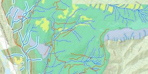
Lab 3 - Storm Surge & Flood Planning (GEOB 270/488)
Lab 3 for GEOB 270, an introductory GIS course at UBC. These are some of the first maps I ever attempted to make in ArcGIS.