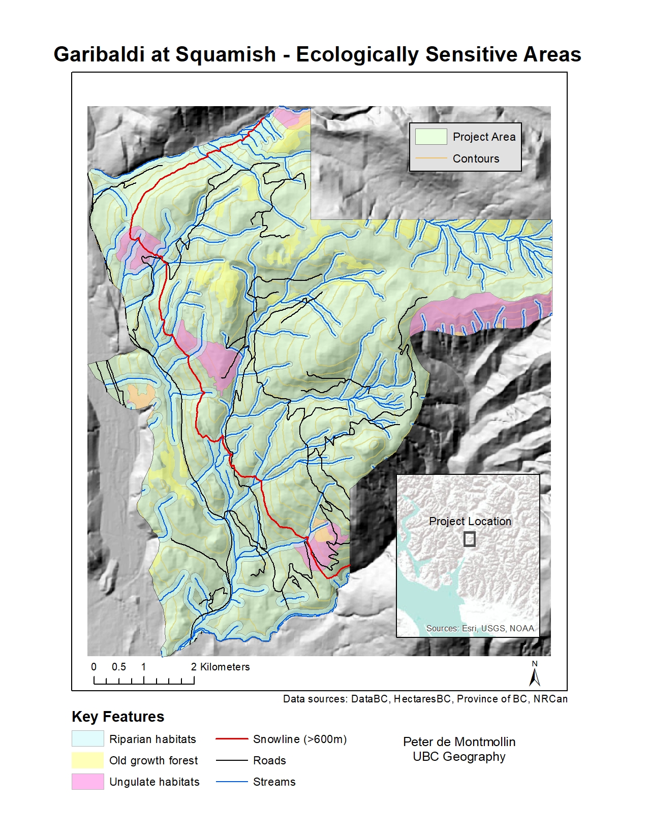
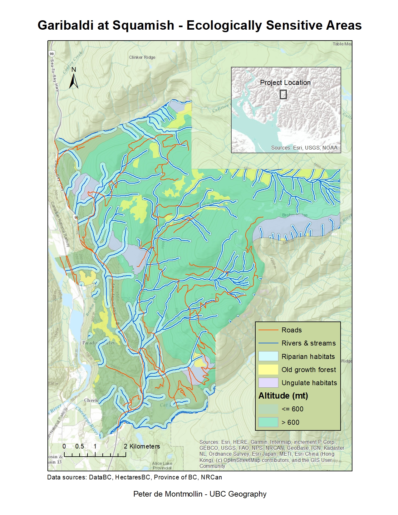
Summary
These two maps display the locations of protected areas – streams and riparian habitats; old growth forest; and ungulate habitats – in the proposed site for Garibaldi at Squamish ski resort project. The project boundary is split along the snowline (>600 meters), which represented by the boundary of the light/dark green areas on Map 1 and by the red line in Map 2. The areas above the snowline (to the east on both maps) are considered potentially suitable for the ski resort, representing 68.2% of the total project area. Of those potentially suitable areas, 38.5% are likely protected based on the analysis carried out here. The streams and riparian habitats account for the largest share of protected areas.
The riparian habitats were mapped by creating a buffer of either 50m or 100m on each side of the streams. The larger buffer was used for stream sections that run entirely or partially below the snowline, which increases the likelihood of fish species being present. However, this buffer does not account for topographical features – e.g., narrow gorges – that might affect the habitat extent, nor does it represent the recorded presence of fish or other species. Therefore, it might be useful to incorporate this sort of data in additional analysis, especially once a specific site is chosen. It would also be helpful to run further analysis with other hypothetical snowlines, based on different climate change scenarios. Other data that should be incorporated into future analysis include the slope and aspect of the mountains within the potential project area, which would impact the design of ski runs. Lastly, future studies would need to analyze the proximity of roads and other existing infrastructure to potential project sites, as this data could affect both the cost and environmental footprint of the proposed resort.
Map 1 - Topographic Basemap
Map 2 - 3D Hillshade